

I raced Ironman Mont Tremblant in its inaugural year in 2012.
In sum: It’s challenging. It’s spectacular. It’s worth doing again.
In this post, I want to share details about the course that will help guide training if you are signed up for this race. Because the course is the same for the 70.3, this post should also prove useful for those of you signed up to do that race.
If you are on the fence about doing this race: Get off the fence, whip out your credit card, and do it. It’s awesome.
(In a previous post, I covered my personal experience during the race. You can find that here.).
The Venue
Mont Tremblant is set up to shelter the number of people that come with an Ironman. It’s not just the 2500 athletes – it’s also their families and sherpas, staff and volunteers. Housing is ample. This was a bit of a switch from my experience racing Lake Placid, where houses begin to sell out just a few weeks after registration.
Prices for lodging vary, depending upon what you need, but remember: this is a ski resort. You’ll pay prices that are in line with this type of venue. Once you get there, be warned: food and drink is fairly expensive (at least by this South Jersey girl’s standards). But, hey, it’s vacation, right?
The condo we rented was only about two miles or so from transition. However, it was high atop a hill, which made walking (before and after the race) challenging. But, no worries, Mont Tremblant has a FREE shuttle that took us up and down the hill all weekend. The schedules are a little bit irregular prior to race day (ranging from every 30 to 45 minutes), but on race day, they ran like clockwork, every 15 minutes or so. Also, if you take the shuttle after 7:15 p.m., you need to call the number on the sign at the shuttle stop because regular service ends and they go on-call.
Be forewarned, however, they won’t let you take your bike on the shuttle. This is a bit of a PITA, particularly if you are alone. For us, we relied on our sherpas to shuttle our bikes.

In the days prior to the race, parking was tight if you got to the village later in the day. On race morning, parking near transition was nonexistent. So, you may need to park further away, and take a shuttle to transition. Or, if you are lucky enough to have awesome sherpas like we do, have them drop you off.
If you don’t speak French, I recommend brushing up on a few key phrases. While almost everyone spoke English, the locals seem very grateful when you make the attempt to speak French. Additionally, trips to the grocery store and similar places would be vastly easier.
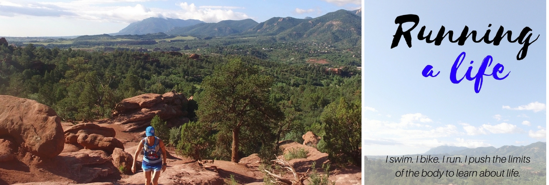
The area itself is gorgeous! Beautiful mountain scenes to be had everywhere you look. Don’t miss the opportunity to take the ski lift to the top of Mont Tremblant to see how beautiful the valley is. We hiked down the mountain two days after the Ironman. Ouch! That hurt. But, the views were worth it. (To see more photos of the race and the area, visit my Flickr Photostream.)

In addition to the mountain, the town has plenty of stuff for the family to do: a kids playground with bungee trampoline thingies, a luge, rock climbing, and more. We don’t have kids, but our friends that do said that the village was kid friendly.
Most of the locals are very much on board with supporting the Ironman. Many of the businesses proudly displayed “Ironman” banners, and there were signs all about the village welcoming and encouraging the athletes. Heck, even the guard at the border knew about the Ironman and wished us well when we first entered Canada. This community support is important to the continued success of the event.
After the Friday night athlete’s dinner and meeting, the village hosted a show and an amazing firework display. It was really cool – even if it did keep me up a little bit past my bed time. 😉
Okay, I know – you really want to know about the race course. Enough with the venue business, right?
The Swim
Ironman Mont Tremblant features a one loop, 2.4 mile course in crystal clear water. The course is a rectangle, starting on one side of little peninsula at the Mont Tremblant Beach & Tennis Club, heading out to the middle of the lake (which you can see below), and then returning on the other side of the peninsula, to exit on the beach. You swim with the buoys on your right shoulder, in a clockwise direction.

In the picture below, you can see the peninsula that you will swim around. However, please note, the swim extends well past this peninsula, which you can see from the picture above.

The swim is a beach start, with approximately 50-75 yards of frontage. The athletes are permitted to get in knee-deep water. Even so, the beach was PACKED with athletes, and behind the athletes, a swarm of thousands of spectators.

The water was cool enough to be wetsuit legal, but it was right on the edge – I’d say about 74 degrees. While normally that would be pretty steamy for a full suit, the 50-degree morning air made it comfortable. I wasn’t too warm or cold for the duration of my swim. If it were a warmer day, I would NOT recommend the full suit. I had swum a few practice swims in warmer weather in the days prior, and it was HOT.
While it was calm on race morning, this lake can get choppy if/when the wind kicks up. We did a few practice swims into some sloppy conditions. Of course, the fuss kicked up from 2500 athletes swimming at once does cause some chop as well.

Transition – T1
As you exit the swim, you will run about 800 yards to the transition tent. They carpet the entire way with nice, fresh red carpet. Yes, this is a pretty long run – and I’m thinking 800 yards is a generous understatement.

Transition area is set up under a big white tent – so all of your bags are covered from the elements, which is a nice touch. You don’t have to worry about the rain getting into your bags the day/night prior.
As you run into the tent, the bike bags are set up on one side, and the run bags are set up on the other. In the middle is the changing area. So, you run in from one side, grab your bike gear bag, run into the changing area and do your thing.
Then, you run out the other side of the changing tent, through the run gear bags, out to transition to grab your bike. I was worried that the run gear bags would be all over the place from everyone running through them, they weren’t. Everything was in place when I returned for T2.
The Bike
After I uploaded my Garmin file from the race into Training Peaks and WKO, the estimate for elevation is 3600 feet (for the entire course – not per loop). While the course is challenging, it’s not that challenging.
If you enjoy and are tactically efficient on rolling hills, this is a great course for you because the course constantly rolls. I joked after the race that I will likely have arthritis or worsened carpal tunnel from all of the shifting. I don’t think there is more than 5-10 miles total – and not consecutive– of flat riding on this course.
Given its rolling nature, this course reminds me of Rev3 Quassy more so than Ironman Lake Placid (for those of you who might have done those races). While it is as challenging as Lake Placid, the structure of the course is quite different. There are no long climbs, but there are plenty of steep climbs. There are no long descents, but lots of little rollers that you can bomb down because there is very little by way of technical turning on this course.
One similarity it shares with Lake Placid is the fact that the final 15 miles or so of the loop along Chemin Duplessis are definitely the most challenging. Remember that when you want to bust your power and heart rate caps along the earlier sections of the course. You’ll pay for it on this road.
The way I see it, there are four main sections to this course, which I’ve identified on the course map below. Each of these sections is an out-and-back, and you do the entire course twice. So, all of the hills you dreaded climbing on the way out, you get to enjoy bombing down them on the way back. And, all of those descents where you embraced the thrill of speed, well on the way back, let’s just say you’ll get to sight see a bit more.
I’ll walk you through the way out and back on each of these sections. (Please note: the mileage is approximated from my Garmin file, and based on one 56 mile loop.)

Section 1: Montee Ryan – miles 1-6, 37-41
As you leave transition, you set out on Montee Ryan. This section is just shy of 6 miles, with rolling hills. In the opening segment, you fling around two round-abouts, which was fun. I imagined I was in the Tour de France, with those amazing aerial shots of the riders going round the circles. In my head, Phil Liggett was talking about what a strong ride I was having with that magical accent of his. Mmm, sexy.

On the way out, Montee Ryan is a net downhill; however, it’s undulating – just like the rest of the course. While you will descend just a bit more, you will still have a few short climbs. So, you know what this means for your way back: more climbing than descending.
However you measure your effort (power, heart rate, rate of perceived exertion), stick with it as you begin this section. Given the excitement of finishing the swim, and the start of the bike, and the relative ease of this section, you will want to push. My recommendation is to avoid that urge. This course rewards discipline and patience – as is typical of hilly courses.
On the first loop, I was passed by many people. Rather than get flustered, I reminded myself of the advice I learned before I did my very first Ironman: “If you are getting passed on the first loop, you are doing it right.” I knew what my numbers were supposed to be, and I stuck there.
On the second loop, you should find it considerably easier to keep your effort disciplined. Fifty-six miles in the saddle has a way of doing that to you.
A brief video snippet of cyclists on Montee Ryan:
Section 2: Route 117 – out and back – miles 7-30
This section is comprised of a series of sweeping, easy-to-moderate-grade rollers. There are no technical turns on this section, so you can really let it eat on the downhills – tuck and go! There is only one hill cialis that I would classify as steep, but it’s short. You can easily see the top. You’ll hit this as an uphill on your way back to town.
The challenge of this section is not any particular hill, but rather the accumulation of the climbing across the rollers. You don’t want to burn matches for each of this little suckers. Keep a steady, even effort.
Route 117 is a wide open highway, which is significant because on a windy day (which it was this year) there will be nothing to protect you from the gusts. I’m 5’3″, 125 pounds, and I was on a Trek Madone road bike without fancy race wheels – and I was getting blown across the highway. I can’t imagine how the guys with the full disc wheels were doing. Hopefully they were heavier than I.
While there aren’t technical turns, the wind will keep you on your toes–or, rather, your handlebars. And, on the second loop, the wind is just annoying–especially when it seems to be blowing from at least three directions. My advice? Pray for calm winds, and, just take it in stride if/when the winds come. Look on the bright side: at least they keep you cool.
The beauty of this section is that it is on freshly paved roads that are silky yummy smooth. Even better: the roads were freshly sweeped by street sweepers, so there is no random debris. Just luscious pavement. My bike, who I like to call Biffy (Biffy for BFF) the Hill Slayer, ate it up like dark chocolate mousse.
The day of this year’s race was not a warm day, and we had partial cloud cover. However, on a hot and/or sunny day, you will cook on this section. There is NO shade protection at all. There are two aid stations on this section – take advantage of them.
Here’s a video overview of the 117 section, filmed by my Twitter friend Ryan: http://vimeo.com/48158024.
Section 3: The Little Jaunt Through Town – miles 30-36 (just shy of finishing the 36th mile)
As you come back to the intersection where Route 117 meets Montee Ryan, you go straight toward the “centre-ville” of Mont Tremblant for a 10k out and back jaunt before you head up Montee Ryan. At this point, you return to a spectator-zone. Much of Route 117 is devoid of any spectators – just a few clumps here and there. Once you hit this out-and-back section, you are in the middle of town, so there are plenty of people eating lunch, drinking beer and making merriment and shouting, “Allez! Allez! Bravo! Bravo!”
You really feel like a bada$$ when people yell at you in French. There’s just something about it. Again, my own personal Tour de France – minus the doping and the peloton.
There was a male spectator on this section wearing an apron with a very realistic picture of a man’s naked body imprinted on the front. I did a triple-take. I really hope that he’s there next year for all of you who will be racing. It will distract you for at least a couple of miles while you think about that one.
He was there for BOTH loops. Huge bonus.
Section 4: Chemin Duplessis – miles 41-56 (end loop)
Without a doubt, Chemin Duplessis is the hardest section of the course. But, when I say “hardest,” I don’t mean impossible. This is a manageable and fair challenge – if you ride smartly and with discipline. (Have I mentioned discipline, yet? It’s a core mantra of mine.)

The way out is a net uphill, with the way back – yes, you guessed it – a net downhill. There is an aid station just after the turnaround.
The hills are fairly steep, and most of them are short. I rode with a 12-28 cassette and was able to sit for the climbs. I stood a little bit on the second loop, but only to stretch my legs in preparation to run. However, John rode with an 11-25, and commented that he found himself needing to stand by the end of some of these. I’m thinking most riders will want the 11/12-28.
There is an exception to the short hills: on the way out, there is a longer climb, that stair-steps upward. John and I estimated that this hill is about a half to a full mile. So, not “long” by hill-climbing standards, but long relative to the other hills on this course. It has a few steep sections, with a few sections that are slightly less steep. Take the opportunity to regroup or fuel as you head up each of these “steps.”
This hill twists and turns a bit, as well. Just as you feel like you’ve made it up this hill, you round a corner, and realize there is more to go. I don’t recommend charging any of the hills on this section for this very reason. They may appear like they end, but they don’t–especially on the way out.
The good news is that you get to ride down this hill when you head back to town. I hit an all-time max speed of 42.2 mph. And, I have no doubt that the braver of you in the bunch could see greater speeds than that.
On the second loop, this section doubles in length – or at least that’s how it feels. Be smart and don’t blow yourself up the first time around. If you push beyond your pacing limits, you will pay. Dearly.
I saw quite a few people (who appeared otherwise fit) walking their bikes on this section during the second loop. Be smarter. Be more disciplined. There is a marathon coming up. And there were plenty of walkers there as well.
T2
T2 is much the same as T1, except you enter from the side you exited in T1. You grab your bag (or a volunteer assists you). When I entered the tent, they were calling numbers, and a volunteer had my bag in her hands. Thank you!!
Into the changing area, do your thing, and out the other side for the run.
The Marathon
 Because I suffered some GI issues, and my nutrition got screwed up (see my previous post), I experienced IMMT as a relatively challenging marathon. I can’t say to what extent my mental perception was skewed by my gut’s anguish.
However, in speaking with others who were better fueled, there was general agreement that Mont Tremblant is a challenging marathon indeed. So, maybe not that skewed…
Was it the hardest marathon I’ve ever done? No. But, I’d say this ranks in the top 5 (including the ultramarathons I’ve done), and I felt that it was harder than IM Lake Placid’s marathon.
The run is a 13.1 mile out-and-back, which can be broken neatly into two, not-quite-equidistance sections: Chemin du Village ~6 miles, and Le P’tit Train du Nord, ~7 miles.

Chemin du Village to beginning of Le P’tit Train du Nord – mile 1-3 and 10-end–>The Hills
As you leave transition, you head out on Chemin du Village, which takes you around the side of Lac Tremblant into a charming little town. This section has ample spectators – even once the rain started pouring down during my second loop.
This is the hillier section of the course, and you climb up your first short, moderate hill within the first mile of the run, as you pass by the swim start from earlier in the day. From my estimation, this section offers more downhill running than uphill running as you are going out during the first three miles, and vice versa when you head back for the final 3 miles of the loop.
The elevation profile confirms this: there is more climbing in the second half of the loop than the first. (Total elevation gain for the marathon: 900 feet, based on Training Peaks analysis.)
This section is run on partially-closed roads, which was a bit of annoyance later in the day as the traffic started backing up. At one point, I was stuck running next to a large RV for about a mile. For those running at night, this may call into a question a safety issue. If you think you are going to be out there late, wear reflective clothing. This will also be useful once you get on the trail section as well, as it could be dark back there when you are running between aid stations. (I’m not sure of this, as it was still daytime when I was out there. Perhaps someone who reads this that was out there at night might be able to help with this question? Thanks!)
Le P’tit Train du Nord, miles 4 – 10 (just shy of finishing 10th mile) –>The Trail
As you hit the 5k mark, you will enter onto a hard-packed clay/gravel/dirt trail, which is well-shaded. This section is comprised of a little more than 5k out and a little more than 5k back. The way out is a slight, almost imperceptible downhill, but when you turn around, you can tell there is a slight grade. It’s not really enough to slow you down, particularly if you can tolerate the bump in effort with your HR.
On the second loop, you will likely feel it more than the first. At least I did. That may be due, in part, to the fact that I couldn’t fuel properly.

The trail itself is a bit narrow, which gets tricky as people start walking – particularly those people who insisted on walking two and three abreast. (Yes, I warned people I was coming, by saying, “Coming up on your left/right.”) I found this behavior a tad thoughtless since those of us who were running had to choose to run into the ditch on the side of the trail or into oncoming traffic in order to get around 2-3 people. The trail is simply not wide enough to handle 3-5 runners across. Single file is optimal.
Le sigh.
It’s also gets tight around the aid stations. Stay alert. I saw a few people trip and go down.
As a trail runner, I really enjoyed this section of the marathon. It was quiet, and I could hear the pitter-patter of our feet, and when it started raining, the sound of the drops as they hit the leaves and the ground were rhythmic music. It provided a good space to get inside of my head, and focus on the task at hand.
The Finish
As you complete the loop, you are routed to enter the cobblestone walkways of the mountain base village of Mont Tremblant. You go right to start your second loop, or left to finish the Ironman. This area is lined with spectators, and is mercifully all downhill. This section can’t be much more than 100 yards or so.

Mike Reilly’s magic voice brings you home – your day is ending, and…
YOU. ARE. AN. IRONMAN.
Perhaps the best recommendation one can give an Ironman course is to say that you will return and do it again. I have no doubt that I will return to Mont Tremblant to do this Ironman again. In fact, it’s looking pretty dang skippy for 2014.
I’ll see you there. 🙂
*~*~*~*~*~*~*~*~*~*~*~*~
My 2012 season has been dedicated to raising money for Gilda’s Club of South Jersey, in honor of my mother who lost her battle with pancreatic cancer on June 12, 2012. It’s not too late to help me reach my goal. To donate, click here.